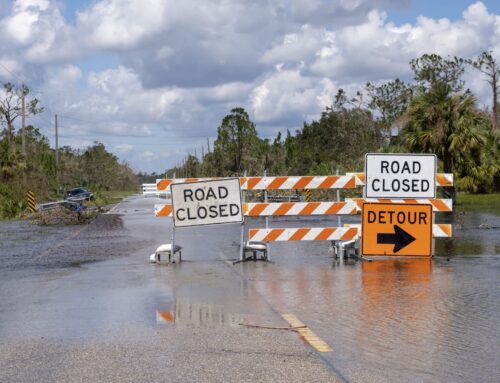
As forecasts call for more rain in throughout the flood ravaged Midwest, it serves as a tragic reminder.
Sadly, these “historic” levels of flooding are far from ancient history for many communities—much of the area experienced then-historic flooding less than 18 months ago. By chance, Taxpayers for Common Sense just this week testified before the Senate on reauthorization of the National Flood Insurance Program. As we told the Senate: “The NFIP is nearly $25 billion in debt and must be reformed to ensure it is financially sustainable, has sufficient incentives for reducing future flood damages and vulnerabilities, provides better protection for taxpayers, and that it promotes mitigation solutions that have long term benefits.”
We don’t want to have to write this Wastebasket yet again.
Yet Another Flood
Floodwaters that peaked in Missouri last week continue to make their way down the Mississippi. In some places, record or near-record flood heights are being recorded. This led some to compare this flood to the Great Midwest Flood of 1993 or other record floods of the past. Truth is, it’s not a good comparison, and in some ways, this flood is more frightening in the long term.
The flood of 1993 was enormous. It affected 150 rivers and tributaries, covered much of the Upper Midwest, extended from May to September, took 50 lives, and cost as much $15 billion (1993 dollars). It was (forgive the pun) a watershed event and led to changes in floodplain policy, buyouts, and flood insurance reform. But in many ways it was still the same type of flood the Mississippi Valley had seen before, just bigger. There was an extended period of rain in the upper basin that led to tributaries flooding, and then the main stem flooding, and persistently high flood waters that peaked at various locations as they made their way downstream. A 1605 history of the DeSoto expedition recorded a similar type of flood on the Mississippi in 1543.
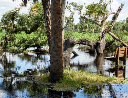
Flash forward to today. This isn’t a summer rainfall flood or a flood coming from spring melt. This is a December/January flood – a time that usually sees low water on the rivers. While this was an unusually wet fall and buckets of rain fell in December, the amount of water making these record or near-record flood heights is much less than what would have been expected in the past, particularly on the main stem of the Mississippi. This leads to the question of why?
It’s because water goes where water wants to go. More than a century of levee building, river channelization, and development throughout the Mississippi River Valley have changed rivers and flood plains. The water has to go somewhere. Flood walls and levees can protect one location, but the water is shuttled downstream. Changes upstream, or down, impact the entire system. What was once a place that “never” flooded, can easily change. Hydrology isn’t fixed.
That’s why in this post-disaster period, people need to take stock of what risks they actually face. And Congress needs to do their part in ensuring people are aware of these risks.
One of the ways this is done is through FEMA mapping the floodplain and designating Special Flood Hazard Areas (SFHA) – areas that have a one percent chance of flooding in any given year (the so-called 100-year floodplain). Property with federally backed mortgages in these areas are required to purchase flood insurance. Unfortunately, this has encouraged construction of flood protection measures that would provide at least that level of protection, effectively removing the mandatory purchase requirement. We say unfortunately because 100-year protection is actually very little protection as some are now finding out. Far better to spend limited funds on mitigation – it has been documented that every dollar spent on mitigation reduces disaster costs by four or more. Also, much of the federal flood insurance is subsidized, effectively masking risk and removing incentives for people to reduce that risk.
Overall our nation’s disaster policies need to be reformed. The federal share of disaster assistance has been increasing, from less than 30 percent after Hurricane Hugo in 1989 to 75 percent after Sandy. Instead, disaster assistance should be provided on a sliding scale contingent on the level of preparation at the state and local level. States and localities should be required to pursue private insurance for public infrastructure before becoming eligible for federal aid. While means-tested premium assistance should be made available, overall flood insurance rates must be more commensurate with risk, and the federal government should put policies into place to encourage the further development of a private market. We absolutely need updated maps so property owners know the risks they face. There needs to be an emphasis – both pre- and post-disaster – on reducing risk and mitigating for future disasters.
But more than anything, lawmakers should be focused on ensuring people know the risks they face.